Old School – Journey With Maps
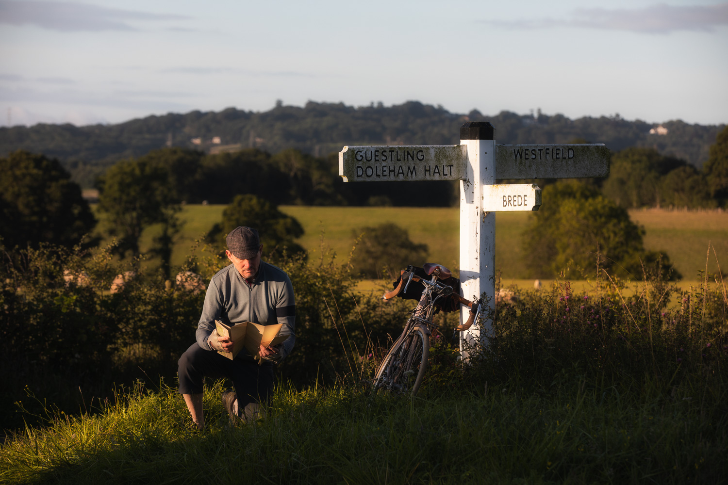
One place you’ll never find me is on Strava. Or pedalling around with one of the nifty GPS-equipped cycling computers that uses satellite tracking to tell me where I am, how fast I am going and how much elevation I’ve gained or lost in the course of my ride. If I am uncertain of my location, I look at a map. As to speed I am generally either going slow or slower, and my legs give me a sufficient indication of how much climbing I’ve done and whether or not a hill is steep or really steep. I am old school in this regard and quite happy to remain that way. For the purposes of authenticity in taking this photo, I used a 1919 cycling map of the south of England. And what is especially nice about it is that on the crooked little Sussex lanes I follow, it is almost perfectly accurate!